|
Google Earth is a geographic information system (GIS) and provides a 3D software
representation of Earth using satellite imagery. It provides you with the
ability to move about the Earth and view any location on the planet from any
altitude or viewing angle.
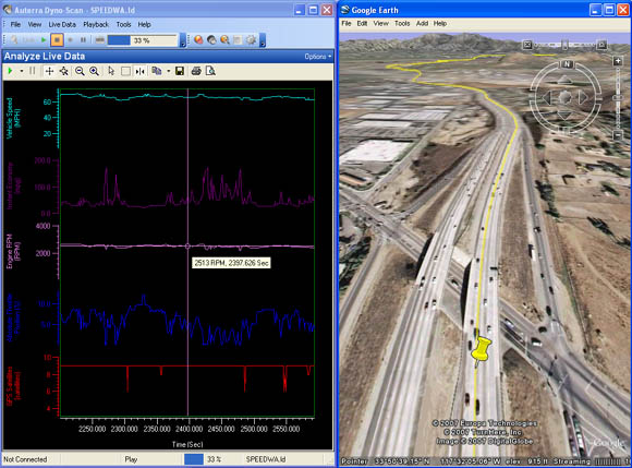
DashDyno and Dyno-Scan for Windows utilize Google Earth to correlate recorded
vehicle sensor data with the vehicle's georeferenced position on Earth. This is
an extremely powerful tool in analyzing vehicle data whether on a racetrack, off
road or around town.
DashDyno records OBD II vehicle sensors data, analog voltages and GPS data
onto the SD card. Dyno-Scan for Windows then opens the file and if it contains
GPS data, Dyno-Scan for Windows interactively sends coordinate information to
Google Earth. You do not need to interact with Google Earth – Dyno-Scan for
Windows updates the camera position and viewing angles automatically.
The Auterra DashDyno SPD records GPS positional data to the SD card if an
external GPS receiver is connected. Almost any GPS receiver, both puck-style and
handheld, will work from
makers like Garmin. Supported
Serial GPS Receivers »
Download a movie
showing the Google Earth feature in action. The movie in AVI format is 15MB.
Google Earth is a free application and may be downloaded from www.earth.google.com.
|